The
CoCoView Resort Weather Forecast
This weather
forecast is intended for CoCoView Resort guests and applies only to
the south side of Roatan
CoCoView is at 16.4°N
Latitude x 86.4°W Longitude
in the
NW Caribbean Sea
in the
NW Caribbean Sea
CoCoView Resort, www.cocoviewresort.com
, 800-510-8164
Skies will be mostly cloudy. There is a slight chance of scattered rain showers. Winds will be westerly in direction at 5 mph to 10 mph or less. Seas will be calm at 1 to 3 ft or less. The air temperatures will range from the high 70sºF to the mid to high 80s ºF or 26°C to 27ºC. Ocean water temperatures are 80°F to 82°F or 26ºC to 27ºC.

 |
The Tropical Weather Outlook
For the North Atlantic...Caribbean Sea and the Gulf of Mexico:1. Gulf of Mexico - Poorly organized tropical depression Nine in the SE Gulf centered near 23.5N 83.9W at 0900 UTC moving W or 270 deg at 8 kt. Maximum sustained winds 30 kt gusts 40 kt. It is expected to slowly intensify in the eastern Gulf during the next 2-3 days then turn northward and recurve across northern Florida Thu and Fri as a tropical storm.
2. Caribbean Sea - Fresh to strong trades are expected to develop later today in the S central Caribbean then persist through Thu...with moderate trades expected elsewhere.
3. ...Special Features...
3a. Hurricane Gaston remains nearly stationary near 30.8N 55.2W at 29/0900 UTC or about 515 nm east of Bermuda. Estimated minimum central pressure is 960 mb. Maximum sustained wind speed is 100 kt with gusts to 120 kt. Scattered to numerous moderate to strong convection is from 29N-32N between 53W-56W.
3b. Tropical Depression Eight is centered near 32.6N 73.0W at 29/0900 UTC or about 200 nm southeast of Cape Hatteras North Carolina moving west-northwest at 9 kt. Estimated minimum central pressure is 1010 mb. Maximum sustained wind speed is 30 kt with gusts to 40 kt. Scattered moderate convection is noted within 90 nm in the southwest quadrant of T.D. Eight.
3c. Tropical Depression Nine is centered near 23.5N 83.9W at 29/0900 UTC or about 85 nm west-northwest of Havana Cuba and about 135 nm west-southwest of Key West Florida moving west at 8 kt. Estimated minimum central pressure is 1007 mb. Maximum sustained wind speed is 30 kt with gusts to 40 kt. Scattered moderate and isolated strong convection is from 21N-23N between 82W-84W.

Fig 3
- Recent changes in the Saharan Air Layer
The Tides: Moon and
Sun
low tide 12:49 am LT Sunrise – 5:34 am LT>80° East
high tide 6:41 am LT Sunset – 6:01 pm LT < 280° NW
low tide 1:00 pm LT Moon Rise – 03:04 pm LT<73° East
high tide 7:14 pm LT Moon Set – 04:08 am LT>286º West
high tide 6:41 am LT Sunset – 6:01 pm LT < 280° NW
low tide 1:00 pm LT Moon Rise – 03:04 pm LT<73° East
high tide 7:14 pm LT Moon Set – 04:08 am LT>286º West
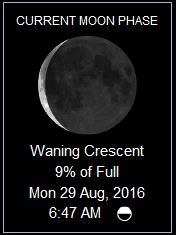
Fig 4 - Moon
No comments:
Post a Comment