The
CoCoView Resort Weather Forecast
This weather
forecast is intended for CoCoView Resort guests and applies only to
the south side of Roatan
CoCoView is at 16.4°N
Latitude x 86.4°W Longitude
in the
NW Caribbean Sea
in the
NW Caribbean Sea
CoCoView Resort, www.cocoviewresort.com
, 800-510-8164
Friday, March 31, 2017
Skies will be partly sunny. Winds will be moderate and easterly in direction at 5 mph to 25 mph. Seas will be moderate to rough at 1 ft. to 4 ft or higher. The air temperatures will range from the low 70sºF to the mid 80s ºF or 22°C to 24ºC. Ocean water temperatures are 79°F to 81°F or 26ºC to 27ºC.
Skies will be partly sunny. Winds will be moderate and easterly in direction at 5 mph to 25 mph. Seas will be moderate to rough at 1 ft. to 4 ft or higher. The air temperatures will range from the low 70sºF to the mid 80s ºF or 22°C to 24ºC. Ocean water temperatures are 79°F to 81°F or 26ºC to 27ºC.

 |
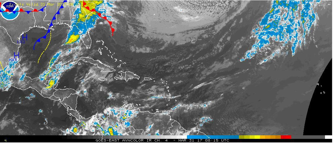 |
The Tropical Weather Outlook
For the North Atlantic...Caribbean Sea and the Gulf of Mexico:
1. There are no tropical cyclones in the Atlantic at this time. The Atlantic hurricane season runs from June 1st through November 30th.
2. Gulf of Mexico - Scattered showers and tstms over NE Florida will shift E ahead of a weak cold front currently reaching from Vermilion Bay, Louisiana to 25N95W. The front shift east today then stall from Ft Myers, Florida to Galveston Bay, Texas Sat and dissipate Sun. Fresh to strong return flow will then dominate across the western Gulf through Sun night and over the eastern basin through Monday night. A second cold front will move off the Texas Coast Sun night reaching from near W central Florida to N of the Yucatan Peninsula Mon night.
3. Caribbean Sea - Building high pres N of the area will support moderate to fresh winds across most of the Caribbean waters...except for strong winds developing at night along the coast of Colombia and across the Gulf of Honduras. Northerly swell moving through the tropical N Atlc will fade Fri with another larger northerly swell invading Sat through Mon.
3a. Conditions remain relatively tranquil across the basin this evening as an middle to upper level ridge prevails over the western Caribbean and mostly dry northwesterly flow aloft over the eastern Caribbean. Within the NW flow...a shear line extends from Guadeloupe to 15N68W. Low-level moisture convergence is maximized across the eastern Caribbean in the vicinity of the shear line generating isolated showers generally from 14N-17N between 62W- 72W. Otherwise...moderate to fresh trades continue and are expected to persist through the weekend into early next week.

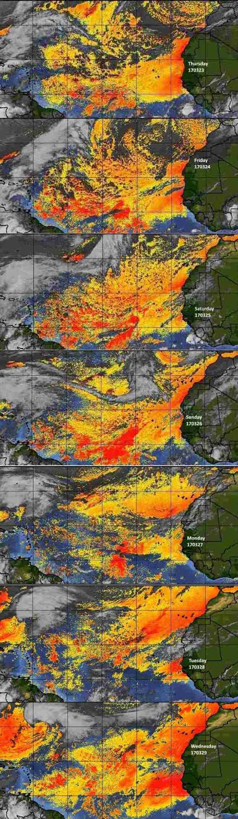
Fig 4
- Recent changes in the Saharan Air Layer
The Tides: Moon and
Sun
low tide 5:25 pm LT Sunrise – 5:42 am LT>85° East
high tide 10:54 am LT Sunset – 5:59 pm LT < 275° NW
low tide 5:58 pm LT Moon Rise – 08:45 am LT<75° East
high tide 12:56 pm LT Moon Set – 9:50 pm LT>287º West
high tide 10:54 am LT Sunset – 5:59 pm LT < 275° NW
low tide 5:58 pm LT Moon Rise – 08:45 am LT<75° East
high tide 12:56 pm LT Moon Set – 9:50 pm LT>287º West

Fig 5 - Moon
Day Light Hours: 12 hours, 16 minutes, (+53s)