The
CoCoView Resort Weather Forecast
This weather
forecast is intended for CoCoView Resort guests and applies only to
the south side of Roatan
CoCoView is at 16.4°N
Latitude x 86.4°W Longitude
in the
NW Caribbean Sea
in the
NW Caribbean Sea
CoCoView Resort, www.cocoviewresort.com
, 800-510-8164
How to use this page:
The title of each of the
figures below is linked to the page where the information originates.
Since I write and post early
in the day and generally do not update the page until the next
morning; by clicking on the link, it allows you, the viewer, to get
the latest information.
This is not only convenient
but allows you to track weather events such as cold fronts and
hurricanes from a single web page.
In addition, in the right
column is a very useful widget. It is a trip planner...yesteryear's
weather at a glance.This widget lets you check historic weather for
your trip dates.
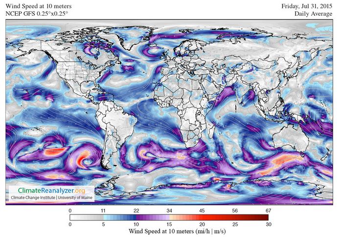
Skies will be sunny. Today, winds will be easterly in direction at 10 mph to 15 mph or more this morning;increasing to 20 mph to 25 mph, this afternoon and evening. Seas will be choppy to rough at 2 ft to 4 ft, or higher. Divers should exercise caution exiting and entering the boats, especially on the afternoon dives.
The air temperatures will range from the low to high 80s ºF or 26°C to 27ºC. Ocean water temperatures are 80°F to 82°F or 26ºC to 28ºC. The moon may appear “blue” this evening due to particulate matter in the atmosphere.


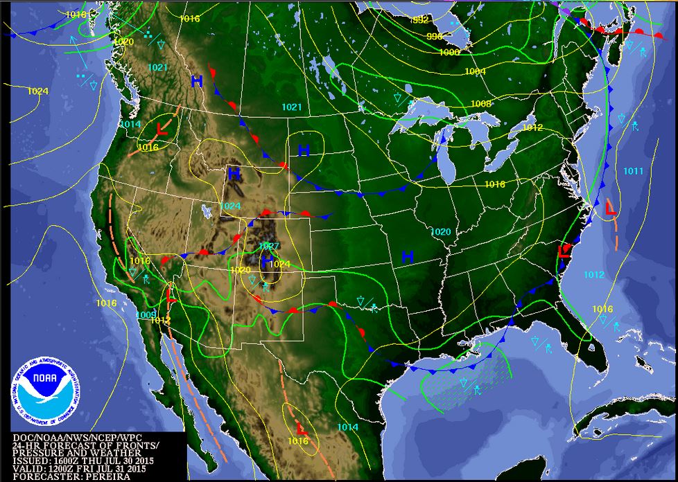
Fig
2a – Today's Jetstream


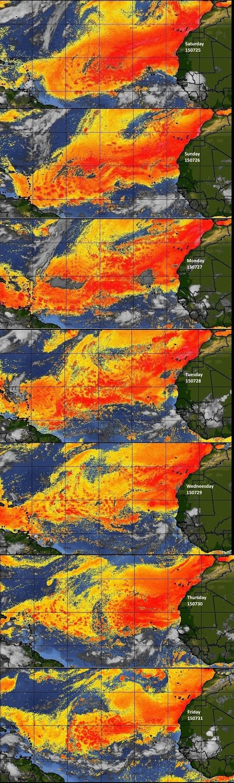 |
Fig 20 - Recent changes in the
Saharan Air Layer
|
 |
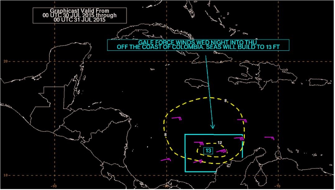
The Tropical Weather Outlook
For the North Atlantic...Caribbean Sea and the Gulf of Mexico:
1. Synopsis...A tropical wave near 75W will move across the remainder of the central Caribbean today...then across the W Caribbean Fri night through Sun...reaching the Yucatan Peninsula Sun night. Another tropical wave currently over the central tropical Atlc will approach 55W late on Sat...and move across the E Caribbean on Mon.
2. There is an area of disturbed weather in the Atlantic at this time. Invest 94L, off the coast of Africa may slowly develop.
3. The Saharan Air Layer (SAL) has decreased slightly in area and density.


Fig 22a - Active Atlantic Ocean Tropical
Waves

Fig 22b - Invest 94L, Computer Models

Fig 22c - Invest 94L, 5 Day Forecast Track

Fig 23 - 48 Hour Tropical Storm Probability
low tide 2:24 am LT Sunrise – 5:28 am LT >71° E
high tide 8:05 am LT Sunset – 6:19 pm LT <289° NW
low tide 2:30 pm LT Moon Rise – 6:37 pm LT >103° E
high tide 8:56 pm LT Moon Set – 5:33 am LT <255° W
high tide 8:05 am LT Sunset – 6:19 pm LT <289° NW
low tide 2:30 pm LT Moon Rise – 6:37 pm LT >103° E
high tide 8:56 pm LT Moon Set – 5:33 am LT <255° W


