The CoCoView Resort Weather Forecast
This weather forecast is intended for CoCoView Resort guests and applies only to the south side of Roatan
CoCoView is at 16.4°N Latitude x 86.4°W Longitude
In the
NW Caribbean Sea
CoCoView Resort, www.cocoviewresort.com , 800-510-8164
The title of each of the figures below is linked to the page where the information originates.
Since I write and post early in the day and generally do not update the page until the next morning; by clicking on the link, it allows you, the viewer, to get the latest information.
This is not only convenient but allows you to track weather events such as cold fronts and hurricanes from a single web page.
In addition, in the right column are two very useful widgets. The first is a tropical weather tracker which shows you the location and forecast track of active tropical storm systems.
The second is a trip planner...yesteryear's weather at a glance.This widget lets you check historic weather for your trip dates.
This weather report will resume on a regular basis on
Monday, Dec. 03, 2012.
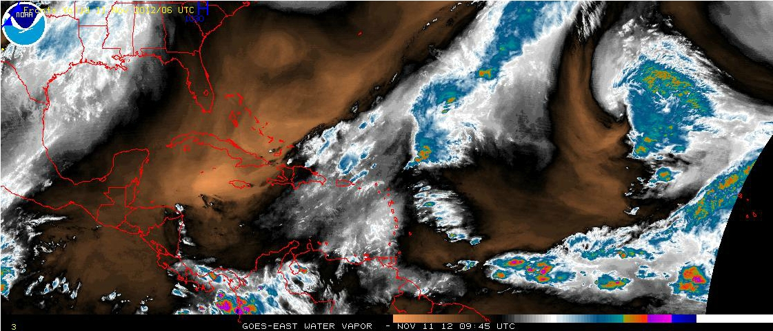
Sunday Nov 11, 2012
Again today, skies will be mostly cloudy. Seas will be moderate at 1 to 4 feet. Winds will be moderate and mostly E to NE in direction at 5 to 15 mph.
There is a continuing chance of intermittent, rain showers and thunderstorms
The next strong cold front will move into the NW Gulf of Mexico on Monday morning, accompanied by very strong northerly winds and building seas. The front will extend from Mississippi to Veracruz, Mexico by Monday night and from the Florida Panhandle to the Bay of Campeche by Tuesday morning before becoming stationary from central Florida to the SW Gulf Wed morning. The front will become diffuse on Thursday.
Moderate NE winds will dominate the Caribbean basin for the remainder of the week.
The air temperatures will range from the high 70s (ºF) to the low 80s (ºF) or 24ºC to 30ºC.
Ocean water temperatures are 83 to 84ºF or 26 to 27ºC. Visibility is generally 20 to 80 feet.


The Tropical Weather Outlook
Tropical cyclone formation is not expected during the next 48 hours.


The Tides: Moon and Sun
low tide 12:04 pm LT Moon Rise – 3:20 am LT
high tide 6:51 am LT Moon Set – 3:27 pm LT
low tide 12:42 am LT Sunrise – 5:48 am LT
high tide 6:04 pm LT Sunset – 5:14 pm LT

This weather report will resume on a regular basis on Monday, Dec. 03, 2012.


