The
CoCoView Resort Weather Forecast
This weather
forecast is intended for CoCoView Resort guests and applies only to
the south side of Roatan
CoCoView is at 16.4°N
Latitude x 86.4°W Longitude
in the
NW Caribbean Sea
in the
NW Caribbean Sea
CoCoView Resort, www.cocoviewresort.com
, 800-510-8164
How to use this page:
The title of each of the
figures below is linked to the page where the information originates.
Since I write and post early
in the day and generally do not update the page until the next
morning; by clicking on the link, it allows you, the viewer, to get
the latest information.
This is not only convenient
but allows you to track weather events such as cold fronts and
hurricanes from a single web page.
In addition, in the right
column is a very useful widget. It is a trip planner...yesteryear's
weather at a glance.This widget lets you check historic weather for
your trip dates.
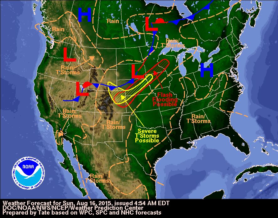
Skies will be partly cloudy. Winds will be mostly easterly in direction at 10 mph to 25 mph today. Seas will be choppy at 2 ft to 4 ft.
The air temperatures will range from the low to high 80s ºF or 26°C to 27ºC. Ocean water temperatures are 80°Fto 82°F or 26ºC to 28ºC. There is a slight chance of scattered rain showers and isolated thunderstorms,especially during the early morning, late night hours.


Fig
2a – Today's Jetstream


 |
Fig 20 - Recent changes in the
Saharan Air Layer
|
 |
The Tropical Weather Outlook
For the North Atlantic...Caribbean Sea and the Gulf of Mexico:
1. Synopsis...A tropical wave in the central Caribbean will move into the W Caribbean Mon. A tropical wave in the central Atlantic will enter tropical N Atlantic waters Mon... reach the E Caribbean Tue and move into the central Caribbean Wed.
2. A tropical wave and a surface low pressure system (Invest 96L) located several hundred miles southwest of the Cape Verde Islands are producing a concentrated area of showers and thunderstorms, which are beginning to show signs of organization. Environmental conditions are expected to be conducive for further development, and a tropical depression could form by midweek as the disturbance moves westward at around 15 mph.
* Formation chance through 48 hours...medium...50 percent
* Formation chance through 5 days...medium...60 percent
All interests in the Bay Islands and on the North Coast of Honduras should track this system as it moves West towards us.
3. The Saharan Air Layer (SAL) has again decreased slightly in area and increased slightly in density.
3. The Saharan Air Layer (SAL) has again decreased slightly in area and increased slightly in density.
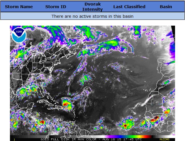

Fig 22a - Active Atlantic Ocean Tropical
Waves


Fig 23 - 48 Hour Tropical Storm Probability
low tide 3:27 am LT Sunrise – 5:32 am LT>75° East
high tide 9:47 am LT Sunset – 6:12 pm LT < 284° West
low tide 3:36 pm LT Moon Rise – 7:07 am LT> 85° East
high tide 9:34 pm LT Moon Set – 7:46 pm LT < 273° West
high tide 9:47 am LT Sunset – 6:12 pm LT < 284° West
low tide 3:36 pm LT Moon Rise – 7:07 am LT> 85° East
high tide 9:34 pm LT Moon Set – 7:46 pm LT < 273° West

No comments:
Post a Comment