The
CoCoView Resort Weather Forecast
This weather
forecast is intended for CoCoView Resort guests and applies only to
the south side of Roatan
CoCoView is at 16.4°N
Latitude x 86.4°W Longitude
in the
NW Caribbean Sea
in the
NW Caribbean Sea
CoCoView Resort, www.cocoviewresort.com
, 800-510-8164
How to use this page:
The title of each of the
figures below is linked to the page where the information originates.
Since I write and post early
in the day and generally do not update the page until the next
morning; by clicking on the link, it allows you, the viewer, to get
the latest information.
This is not only convenient
but allows you to track weather events such as cold fronts and
hurricanes from a single web page.
In addition, in the right
column is a very useful widget. It is a trip planner...yesteryear's
weather at a glance.This widget lets you check historic weather for
your trip dates.
Wednesday, August 19, 2015
Skies will be partly cloudy. Winds will be mostly easterly in direction at 15 mph to 20 mph this morning; increasing to 20 mph to 30 mph this afternoon and evening. Seas will be choppy at 2 ft to 4 ft.
Divers should exercise caution exiting and entering the boats, especially on the afternoon dives.
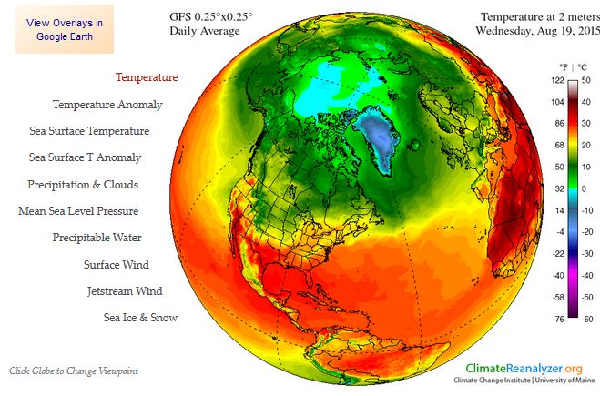
The air temperatures will range from the low to high 80s ºF or 26°C to 27ºC. Ocean water temperatures are 80°F to 82°F or 26ºC to 28ºC.


Fig
2a – Today's Jetstream


 |
Fig 20 - Recent changes in the
Saharan Air Layer
|
 |
The Tropical Weather Outlook
For the North Atlantic...Caribbean Sea and the Gulf of Mexico: 1. Synopsis...A tropical wave will enter the E Caribbean Wed...reach the central Caribbean Thu and Fri and across the W Caribbean Sat and Sat night. Tropical storm Danny in the E Atlantic is forecast to strengthen to hurricane intensity...passing 55W on Sun with tropical storm force and greater conditions spreading across the tropical waters E of the Lesser Antilles.
All interests in the Bay Islands and on the North Coast of Honduras should track this system as it moves west towards us.
2. The Saharan Air Layer (SAL) has again decreased in area and in density.
By:
Bob Henson
, 11:33 PM GMT on August 18, 2015
Figure 1. Visible image of Danny collected by the GOES-East floater satellite at 1945 GMT Tuesday (3:45 pm EDT), just before it was upgraded to tropical-storm status. Image credit: NOAA/NESDIS.
Figure 2. NHC’s outlook for Tropical Storm Danny as of 5:00 pm EDT Tuesday.
There was little change in the prognosis for Danny from the NHC’s 11:00 am EDT advisory to the 5:00 pm edition (see Figure 2 above). Wind shear around Danny should remain below 10 - 15 mph for most of the next five days, and sea-surface temperatures along Danny’s path will average near 28°C (82°F) for that entire period. Both of these factors point toward a good chance that Danny will strengthen over the next several days. The NHC projects that Danny will become the year’s first Atlantic hurricane by Thursday morning and grow to Category 2 strength (sustained winds of 100 mph) by Saturday. This long-range forecast is consistent with the statistical models that show more skill than dynamical models at intensity prediction beyond 3 days. Of the two dynamical models most trusted for intensity forecasting, the recently upgraded HWRF has consistently called for Danny to develop into at least a strong Category 1 hurricane. The GFDL failed to develop Danny until today’s runs, but its 1200 GMT Tuesday run brings Danny well above the hurricane-strength threshold, much more in line with the HWRF. If Danny continues to develop at a healthy clip, a period of more rapid intensification later this week cannot be ruled out. Such phases remain very difficult to predict.
Most of the dynamical track models now move Danny toward the west-northwest at a fairly modest pace until this weekend, when a building ridge to the north should help push it at a faster rate. By that point, Danny would draw on oceanic heat content that gradually increases along its path. However, a large area of dry air and Saharan dust north of Danny may inhibit its development at times. With a solid convective core, Danny might be able to fend off interference from this dry, dusty air until it encounters pockets of stronger wind shear, a possibility that long-range models are suggesting for this weekend into early next week. Thus, there is no guarantee that Danny would maintain whatever strength it attains in the deep tropics, and it is still far too early to predict with any confidence how much of a threat Danny might pose to the United States if it survives the long trek. A small change in trajectory now would have big implications for the track many days from now.
Figure 3. Intensity forecasts for Tropical Storm Danny as of 1800 GMT Tuesday, August 18. Models shown are GFDL=Geophysical Fluid Dynamic Laboratory model; HWRF=Hurricane Weather Research Forecasting model; ICON and IVCN = blends of statistical and dynamical model guidance used at the National Hurricane Center.


Fig 22a - Active Atlantic Ocean Tropical
Waves

Fig 23 - 48 Hour Tropical Storm Probability

Fig 23a - TS Danny Distance from Roatan

Fig 23b - TS Danny Storm Statistic

Fig 23c - TS Danny Computer Models
Not Available
Fig 23b - TS Danny Storm US Navy Fleet Computer Model
low tide 5:37 am LT Sunrise – 5:33 am LT>76° East
high tide 1:14 pm LT Sunset – 6:10 pm LT < 283° West
low tide 6:15 pm LT Moon Rise – 9:28 am LT> 97° East
high tide 11:26 pm LT Moon Set – 9:42 pm LT < 261° West
ay
Light Hours: 12 hours, 36 minutes, (-47 sec)high tide 1:14 pm LT Sunset – 6:10 pm LT < 283° West
low tide 6:15 pm LT Moon Rise – 9:28 am LT> 97° East
high tide 11:26 pm LT Moon Set – 9:42 pm LT < 261° West

No comments:
Post a Comment