The
CoCoView Resort Weather Forecast
This weather
forecast is intended for CoCoView Resort guests and applies only to
the south side of Roatan
CoCoView is at 16.4°N
Latitude x 86.4°W Longitude
in the
NW Caribbean Sea
in the
NW Caribbean Sea
CoCoView Resort, www.cocoviewresort.com
, 800-510-8164
How to use this page:
The title of each of the
figures below is linked to the page where the information originates.
Since I write and post early
in the day and generally do not update the page until the next
morning; by clicking on the link, it allows you, the viewer, to get
the latest information.
This is not only convenient
but allows you to track weather events such as cold fronts and
hurricanes from a single web page.
In addition, in the right
column is a very useful widget. It is a trip planner...yesteryear's
weather at a glance.This widget lets you check historic weather for
your trip dates.
Skies will be partly cloudy. Winds will be easterly in direction at 5 mph to10 mph today or less. Seas will be calm at 1 ft to 2ft.
The air temperatures will range from the low to high 80s ºF or 26°C to 27ºC. Ocean water temperatures are 80°F to 82°F or 26ºC to 28ºC.
There is a very slight chance of scattered rain showers and isolated thunderstorms.


Fig
2a – Today's Jetstream


 |
Fig 20 - Recent changes in the
Saharan Air Layer
|
 |
The Tropical Weather Outlook
For the North Atlantic...Caribbean Sea and the Gulf of Mexico:
Synopsis..
Synopsis..
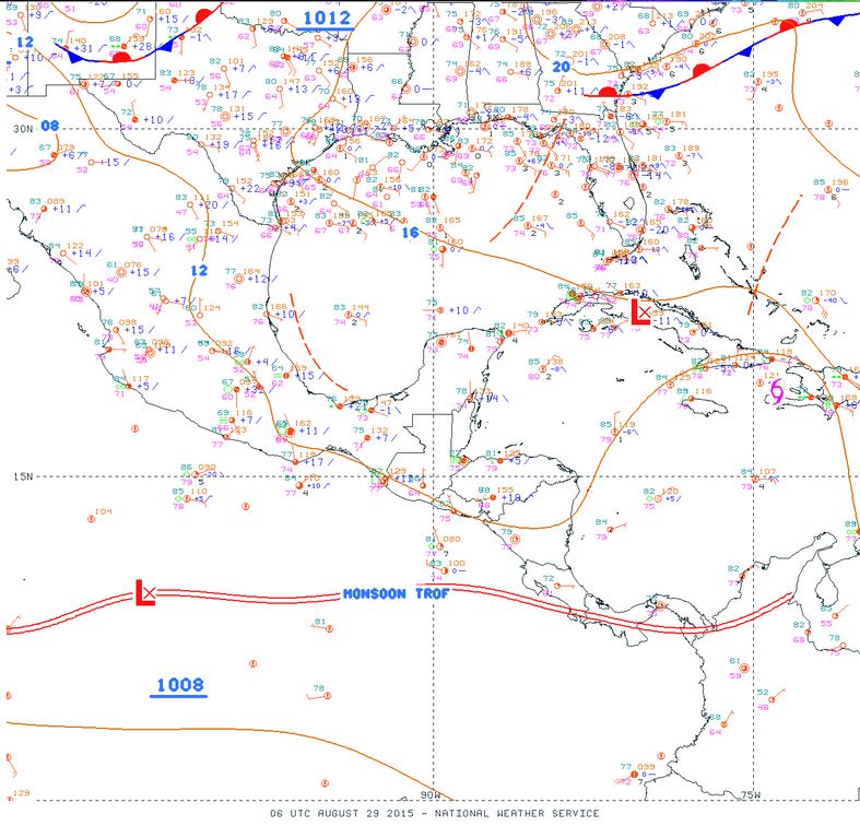
1. The National Hurricane Center has issued the last advisory on Tropical Storm Erika. The remnants of Erika, a trough of low pressure, are currently located near central Cuba and the central Bahamas and moving west-northwestward at 20 to 25 mph. This system is producing disorganized thunderstorm activity, and recent satellite wind data indicate it is producing winds to tropical storm force. Upper-level winds are currently not favorable for re-development of the system into a tropical cyclone. However, conditions may become more conducive Sunday or Monday while it moves northwestward to northward over the eastern Gulf of Mexico. Regardless of re-development, the remnants of Erika are expected to spread locally heavy rains and gusty winds across portions of the Bahamas, central and eastern Cuba, and central and southern Florida during the next couple of days. Additional information on this system can be found in marine forecasts and local forecast products issued by the National Weather Service and the meteorological services of Cuba and the Bahamas.
* Formation chance through 48 hours...low...30 percent
* Formation chance through 5 days...medium...40 percent
2. Fresh to strong trade winds will return to central portions of the Caribbean tonight through Sun as Erika exits the area.
3. Shower and thunderstorm activity associated with a low pressure area, designated Invest 99L, located about 175 miles west of Conakry, Guinea, continue to become better organized. A tropical depression could form during the next day or so while the system moves northwestward and then west-northwestward toward the Cape Verde Islands at 10 to 15 mph. Interests in the Cape Verde and Bay Islands should monitor the progress of this system.
* Formation chance through 48 hours...high...70 percent
* Formation chance through 5 days...high...90 percent
4. The Saharan Air Layer (SAL) has decreased slightly in both density and area. See Fig. 20.


Fig 22a - Active Atlantic Ocean Tropical
Waves

Fig 23 - 48 Hour Tropical Storm Probability

Fig 23a - Invest 99L, Distance from Roatan
low tide 1:58 am LT Sunrise – 5:34 am LT>80° East
high tide 7:58 am LT Sunset – 6:03 pm LT < 280° West
low tide 2:14 pm LT Moon Rise – 6:07 pm LT> 96° East
high tide 8:21 pm LT Moon Set – 5:17 am LT < 261° West
high tide 7:58 am LT Sunset – 6:03 pm LT < 280° West
low tide 2:14 pm LT Moon Rise – 6:07 pm LT> 96° East
high tide 8:21 pm LT Moon Set – 5:17 am LT < 261° West

No comments:
Post a Comment