The
CoCoView Resort Weather Forecast
This weather
forecast is intended for CoCoView Resort guests and applies only to
the south side of Roatan
CoCoView is at 16.4°N
Latitude x 86.4°W Longitude
in the
NW Caribbean Sea
in the
NW Caribbean Sea
CoCoView Resort, www.cocoviewresort.com
, 800-510-8164
How to use this page:
The title of each of the
figures below is linked to the page where the information originates.
Since I write and post early
in the day and generally do not update the page until the next
morning; by clicking on the link, it allows you, the viewer, to get
the latest information.
This is not only convenient
but allows you to track weather events such as cold fronts and
hurricanes from a single web page.
In addition, in the right
column is a very useful widget. It is a trip planner...yesteryear's
weather at a glance.This widget lets you check historic weather for
your trip dates.
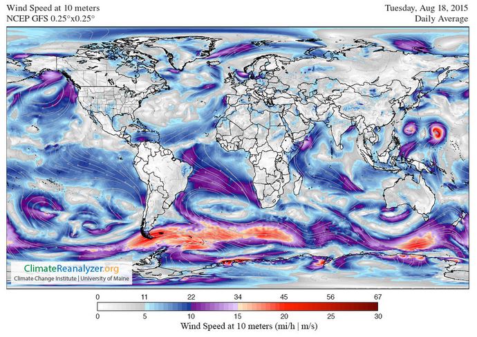
Tuesday, August 18, 2015
Skies will be partly cloudy. Winds will be mostly easterly in direction at 10 mph to 15 mph this morning; increasing to 20 mph to 30 mph this afternoon and evening. Seas will be choppy at 2 ft to 4 ft.
Divers should exercise caution exiting and entering the boats, especially on the afternoon dives.
The air temperatures will range from the low to high 80s ºF or 26°C to 27ºC. Ocean water temperatures are 80°F to 82°F or 26ºC to 28ºC.


Fig
2a – Today's Jetstream


 |
Fig 20 - Recent changes in the
Saharan Air Layer
|
 |
The Tropical Weather Outlook
For the North Atlantic...Caribbean Sea and the Gulf of Mexico:
1. Synopsis...A tropical wave will reach the tropical N Atlantic waters early this morning. The tropical wave will cross the Lesser Antilles early Wed...move across the E Caribbean Wed and Thu...then across the central Caribbean Thu night through Fri night...and W Caribbean Sat through Sun.
2. Thunderstorm activity associated with an area of low pressure located several hundred miles west-southwest of the Cape Verde Islands has continued to become better organized this morning. Environmental conditions are conducive for additional development, and only a slight increase in organization would result in the formation of a tropical depression later today while the system moves westward to west-northwestward at 10 to 15 mph.
* Formation chance through 48 hours...high...90 percent
* Formation chance through 5 days...high...90 percent
All interests in the Bay Islands and on the North Coast of Honduras should track this system as it moves west towards us.
As of 1100 am AST, Invest 96L was upgraded to TD4
3. The Saharan Air Layer (SAL) has decreased slightly in area and in density.
The fourth tropical depression of 2015 has developed in the central
tropical Atlantic, and it could become the year’s first Atlantic
hurricane by later this week. Advisories on TD 4
were initiated by the National Hurricane Center (NHC) at 11:00 am EDT
Tuesday. The depression was located near 10.6°N, 36.5°W, moving west at
about 13 mph. Top sustained winds were estimated at 35 mph, just below
tropical-storm strength (40 mph). TD 4 is expected to become Tropical
Storm Danny, the season’s fourth named system, by later tonight, according to the NHC.
Interestingly, this is the first named system of the 2015 Atlantic
season to begin its official life as a tropical depression. Ana began as a subtropical storm, while Bill and Claudette were tracked as tropical storms by NHC from the outset.

Figure 1. Infrared satellite image of a gradually organizing TD 4, collected by the GOES-East floater satellite at 1545 GMT (11:45 am EDT) Tuesday. Image credit: NOAA/NESDIS.

Figure 2. GOES-East floater visible image of TD 4 at 1545 GMT (11:45 am EDT) Tuesday. Image credit: RAMMB/CIRA.
The outlook for TD 4
As the first Cape Verde depression of the year, TD 4 formed well east of the Caribbean, where El Niño has been producing record amounts of vertical wind shear this summer. Even though the Atlantic tropics have been largely suppressed, as expected with this year’s strong El Niño event, TD 4 appears to be finding a window in time and space where some development is possible. Wind shear near the system is quite low, only around 5 knots (see Figure 3), and the region of stronger upper-level westerlies to the north of TD 4 could end up helping to support development by serving as an outflow channel. A massive area of Saharan dust and dry air lies just north of TD 4, but as mentioned in Tuesday’s morning’s NHC discussion, it appears that the depression is surrounded by enough moisture that it may be able to intensify even if it ingests some of this dry, dusty air.

Figure 3. Wind shear between upper and lower layers of the atmosphere across the North Atlantic. Lower values of shear, as shown above TD 4 (far right), support tropical development. Image credit: University of Wisconsin-CIMMS/NESDIS.

Figure 4. NHC’s outlook for TD 4 as of 11:00 am EDT Tuesday. Image credit: NOAA/NHC.
The 11 am EDT outlook from NHC brings TD 4 to hurricane strength by Friday morning and to Category 2 strength (sustained winds of 100 mph) by Saturday. This long-range forecast is consistent with the statistical models that show more skill than dynamical models at intensity prediction beyond 3 days. Of the two dynamical models most trusted for intensity forecasting, the HWRF has consistently called for TD 4 to develop into at least a strong Category 1 hurricane, while the GFDL has failed to develop TD 4, so the recently upgraded HWRF may end up closer to the mark in this case. Intensity prediction is still very challenging, so it is quite possible that TD 4 could be substantially weaker or stronger by this weekend than the current NHC forecast indicates. Over the last two years, the average 5-day error in NHC intensity projections was around 15 mph, or a bit more than half a category on the Saffir-Simpson Hurricane Wind Scale. This is substantially better than prior years: between 2000 and 2010, intensity errors at 5 days averaged more than 25 mph.
Looking ahead
TD 4 is many days away from any threat to the Leeward Islands. Most of the dynamical track models keep TD 4 moving west to west-northwest at a modest pace. The model consensus keeps TD 4 east of 50°W longitude until this weekend, when a building ridge to the north of TD 4 should help push it at a faster rate toward the islands. By that point, the system would draw on oceanic heat content that gradually increases along its path. It is far too early to predict with any confidence how much of a threat TD 4 might pose to the United States next week. Only a small change in trajectory this far out can have big implications for the track many days from now, and it remains to be seen whether dry air and dust will keep TD 4 from maximizing its potential for development.
3. The Saharan Air Layer (SAL) has decreased slightly in area and in density.
By:
Bob Henson
, 4:46 PM GMT on August 18, 2015
Figure 1. Infrared satellite image of a gradually organizing TD 4, collected by the GOES-East floater satellite at 1545 GMT (11:45 am EDT) Tuesday. Image credit: NOAA/NESDIS.
Figure 2. GOES-East floater visible image of TD 4 at 1545 GMT (11:45 am EDT) Tuesday. Image credit: RAMMB/CIRA.
The outlook for TD 4
As the first Cape Verde depression of the year, TD 4 formed well east of the Caribbean, where El Niño has been producing record amounts of vertical wind shear this summer. Even though the Atlantic tropics have been largely suppressed, as expected with this year’s strong El Niño event, TD 4 appears to be finding a window in time and space where some development is possible. Wind shear near the system is quite low, only around 5 knots (see Figure 3), and the region of stronger upper-level westerlies to the north of TD 4 could end up helping to support development by serving as an outflow channel. A massive area of Saharan dust and dry air lies just north of TD 4, but as mentioned in Tuesday’s morning’s NHC discussion, it appears that the depression is surrounded by enough moisture that it may be able to intensify even if it ingests some of this dry, dusty air.
Figure 3. Wind shear between upper and lower layers of the atmosphere across the North Atlantic. Lower values of shear, as shown above TD 4 (far right), support tropical development. Image credit: University of Wisconsin-CIMMS/NESDIS.
Figure 4. NHC’s outlook for TD 4 as of 11:00 am EDT Tuesday. Image credit: NOAA/NHC.
The 11 am EDT outlook from NHC brings TD 4 to hurricane strength by Friday morning and to Category 2 strength (sustained winds of 100 mph) by Saturday. This long-range forecast is consistent with the statistical models that show more skill than dynamical models at intensity prediction beyond 3 days. Of the two dynamical models most trusted for intensity forecasting, the HWRF has consistently called for TD 4 to develop into at least a strong Category 1 hurricane, while the GFDL has failed to develop TD 4, so the recently upgraded HWRF may end up closer to the mark in this case. Intensity prediction is still very challenging, so it is quite possible that TD 4 could be substantially weaker or stronger by this weekend than the current NHC forecast indicates. Over the last two years, the average 5-day error in NHC intensity projections was around 15 mph, or a bit more than half a category on the Saffir-Simpson Hurricane Wind Scale. This is substantially better than prior years: between 2000 and 2010, intensity errors at 5 days averaged more than 25 mph.
Looking ahead
TD 4 is many days away from any threat to the Leeward Islands. Most of the dynamical track models keep TD 4 moving west to west-northwest at a modest pace. The model consensus keeps TD 4 east of 50°W longitude until this weekend, when a building ridge to the north of TD 4 should help push it at a faster rate toward the islands. By that point, the system would draw on oceanic heat content that gradually increases along its path. It is far too early to predict with any confidence how much of a threat TD 4 might pose to the United States next week. Only a small change in trajectory this far out can have big implications for the track many days from now, and it remains to be seen whether dry air and dust will keep TD 4 from maximizing its potential for development.


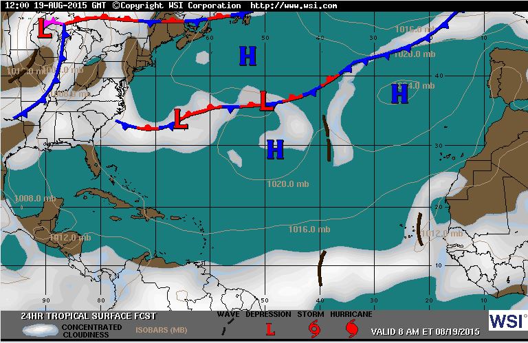
Fig 22a - Active Atlantic Ocean Tropical
Waves


Fig 23 - 48 Hour Tropical Storm Probability

Fig 24 - TD4 5 Day Forecast Track
low tide 4:45 am LT Sunrise – 5:32 am LT>76° East
high tide 11:02 am LT Sunset – 6:10 pm LT < 284° West
low tide 5:08 pm LT Moon Rise – 8:41 am LT> 93° East
high tide 10:36 pm LT Moon Set – 9:03 pm LT < 265° West
high tide 11:02 am LT Sunset – 6:10 pm LT < 284° West
low tide 5:08 pm LT Moon Rise – 8:41 am LT> 93° East
high tide 10:36 pm LT Moon Set – 9:03 pm LT < 265° West

No comments:
Post a Comment