The
CoCoView Resort Weather Forecast
This weather
forecast is intended for CoCoView Resort guests and applies only to
the south side of Roatan
CoCoView is at 16.4°N
Latitude x 86.4°W Longitude
in the
NW Caribbean Sea
in the
NW Caribbean Sea
CoCoView Resort, www.cocoviewresort.com
, 800-510-8164
How to use this page:
The title of each of the
figures below is linked to the page where the information originates.
Since I write and post early
in the day and generally do not update the page until the next
morning; by clicking on the link, it allows you, the viewer, to get
the latest information.
This is not only convenient
but allows you to track weather events such as cold fronts and
hurricanes from a single web page.
In addition, in the right
column is a very useful widget. It is a trip planner...yesteryear's
weather at a glance.This widget lets you check historic weather for
your trip dates.
2014 Hurricane Outlook
and Forecasts
The hurricane season in this
hemisphere starts on June 01 and ends on November 30.
During that time frame, for
your convenience, you will find a section below titled, "Tropical
Weather Outlook".
It will contain the daily
tropical storm outlook, forecast and storm track(s).
NOAA predicts
near-normal or below-normal 2014 Atlantic hurricane season.
El Niño is expected to
develop and suppress the number and intensity of tropical cyclones.
This year, the Saharan Air
Layer (SAL) has been decreasing in size and density since May 21,
2014. This is important because it has been postulated, that the SAL,
a cool, dry, layer of air which contains particles, may inhibit the
formation of tropical storms and hurricanes. In addition, as it
decreases in size and density, the probability of tropical storm
formation may increase.
The outlook calls for a 50
percent chance of a below-normal season, a 40 percent chance of a
near-normal season, and only a 10 percent chance of an above-normal
season. For the six-month hurricane season, which begins June
1, NOAA predicts a 70 percent likelihood of 8 to 13 named storms
(winds of 39 mph or higher), of which 3 to 6 could become hurricanes
(winds of 74 mph or higher), including 1 to 2 major hurricanes
(Category 3, 4 or 5; winds of 111 mph or higher).
These numbers are near or
below the seasonal averages of 12 named storms, six hurricanes and
three major hurricanes, based on the average from 1981 to 2010. The
Atlantic hurricane region includes the North Atlantic Ocean,
Caribbean Sea and Gulf of Mexico.
Sunday,
August 24, 2017
Today,
skies will be mostly sunny. Winds will be very light and variable in
direction at 5 mph or less. Seas
will be calm at 1 to 3 feet or less. There is a very slight chance of
scattered rain showers and isolated thunderstorms, especially during
the early morning, late night hours.
The
air temperatures will range from the mid to high 70s (ºF) to the mid
to high 80s (ºF) or 24ºC to 26ºC. It will feel much warmer then
this with little or no wind. Expect these weather conditions to
prevail through midday Wednesday
Ocean
water temperatures are 82°F to 84°F or 24ºC to 25ºC. Visibility
is 20 to 80 ft.


 |
|
|


 |
Fig 19 - Recent changes in the
Saharan Air Layer
|

The Tropical Weather Outlook
Invest 96L has strengthen and is now Tropical Storm Cristobal. It is moving northwestward near the southeastern Bahamas. It currently poses no danger to the Bay Islands and North Coast of Honduras.A tropical wave will move into the tropical N Atlantic Tuesday night and reach the eastern Caribbean by Thursday. New tropical storm formation is not expected in the next 5 days.
The Saharan Air Layer has decreased markedly, this past week, in both size and density. If this trend continues, expect tropical storm and cyclone formation to increase in the next 4 to 8 weeks. Hurricane season in the western hemisphere statistically peaks on September 11th.
Tropical Storm Cristobal
Public AdvisoryThe overall cloud pattern of Cristobal has changed little since
the previous advisory. Flight-level wind data from the Air Force
Reserve and NOAA reconnaissance aircraft investigating Cristobal
earlier this morning indicated that the low-level and mid-level
circulations were not vertically aligned, suggesting that the
inner-core wind field of the cyclone is still trying to form. The
initial intensity of 40 kt is based on 1000-ft flight-level winds of
49 kt and a few reliable SFMR winds of near 40 kt.
The initial motion is an uncertain 345/6 kt. There are significant
differences noted between the various NHC models. The GFS model and
the GFS ensemble mean shear the mid-level circulation southward from
the current position, and take the remaining shallow and weak
low-level circulation quickly northeastward, which seems unlikely at
this time given the overall large structure of the cyclone noted in
recon, satellite, and upper-air data. In contrast, the ECMWF, UKMET,
and navgem models keep Cristobal as a deeper, stronger, and more
vertically coherent cyclone, moving the system only slowly
north-northwestward or northwestward for the next 72 hours or so as
a strong mid-latitude trough over the Carolinas lifts out to the
northeast. As the trough lifts out, the subtropical ridge is
expected to build back in to the north of Cristobal until a second
trough moves off the U.S. East Coast in 4-5 days and weakens the
ridge again, allowing Cristobal to move slowly northward and then
accelerate off to the northeast. More weight has been placed the on
the ECMWF-UKMET-navgem solutions, and the official forecast track
remains near the left side of the guidance envelope.
Light to moderate northwesterly to northerly shear is expected to
affect Cristobal throughout the forecast period. However, the shear
is not forecast to be strong enough to prevent at least slow
strengthening, especially given that the upper-level flow is
expected to be quite diffluent and divergent through at least 48
hours, which will act to enhance convective development. The NHC
intensity forecast remains close to SHIPS guidance.
Forecast positions and Max winds
Init 24/1500z 23.6n 73.1w 40 kt 45 mph
12h 25/0000z 24.2n 73.4w 45 kt 50 mph
24h 25/1200z 24.9n 73.6w 50 kt 60 mph
36h 26/0000z 25.7n 73.8w 55 kt 65 mph
48h 26/1200z 26.6n 74.1w 60 kt 70 mph
72h 27/1200z 29.3n 74.9w 65 kt 75 mph
96h 28/1200z 32.2n 73.3w 70 kt 80 mph
120h 29/1200z 35.0n 67.3w 75 kt 85 mph
$$
forecaster Stewart


Fig 21a - Graphical 5 Day Tropical Weather Outlook


Fig 23 - 48 Hour Tropical Storm Probability


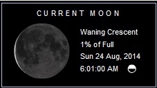
low tide 1:49 am LT Moon Rise – 4:44 am LT
high tide 7:56 am LT Moon Set –5:38 pm LT
low tide 1:53 pm LT Sunrise – 5:33 am LT
high tide 8:07 pm LT Sunset – 6:06 pm LT
high tide 7:56 am LT Moon Set –5:38 pm LT
low tide 1:53 pm LT Sunrise – 5:33 am LT
high tide 8:07 pm LT Sunset – 6:06 pm LT
No comments:
Post a Comment