For Friday, Sept 24, 2010
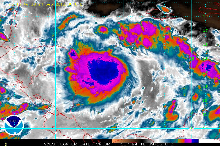
Tropical wave 95L became tropical storm Matthew yesterday. At 0300 am today, it was about 467 miles ESE of us and 230 miles from Gracias Adios. It is moving W at 16mph. Maximum sustained winds were 50 mph. The pressure was 1000 millibars.
Today skies will be cloudy with bands of rain. The seas are rough with wave heights of 2 to 4 feet or higher. Winds will be mostly ENE at 10 to 15 knots or higher and gusting. Wind and seas will strengthen later today, as TS Matthew approaches.
Gracias Adios is already feeling the first effects of Matthew.
It remains a very serious threat to the North Coast of Honduras and the Bay Islands.  |
| Fig 1- The Center of TS Matthew at 0300am LT_100924 |
No comments:
Post a Comment