The CoCoView
Resort Weather Forecast
This weather forecast is intended for CoCoView Resort guests and applies only to the south side of Roatan
CoCoView is at 16.4°N Latitude x 86.4°W Longitude
in the
NW Caribbean Sea
CoCoView Resort, www.cocoviewresort.com , 800-510-8164
How to use this page:
The title of each of the figures below is linked to the page where the information originates.
Since I write and post early in the day and generally do not update the page until the next morning; by clicking on the link, it allows you, the viewer, to get the latest information.
This is not only convenient but allows you to track weather events such as cold fronts and hurricanes from a single web page.
In addition, in the right column is a very useful widget. It is a trip planner...yesteryear's weather at a glance.This widget lets you check historic weather for your trip dates.
Saturday Sept 07, 2013
Again,
today, skies
will be partly sunny.
Seas
will be calm to moderate at 1 to 3 feet.
Winds will be ESE in direction, this morning, at 5 mph or less;
increasing this afternoon and evening to 10 to 15 mph. In the
afternoon, winds will be ENE in direction. Expect these weather
conditions to prevail through Tuesday.There is a slight chance of scattered rain showers and isolated thunderstorms.
The air temperatures will range from the mid 80s (ºF) to the low 90s (ºF) or 25ºC to 32ºC.
Ocean water temperatures are 82°F to 84ºF or 27ºC to 28ºC. Visibility is generally 20 to 80 feet.


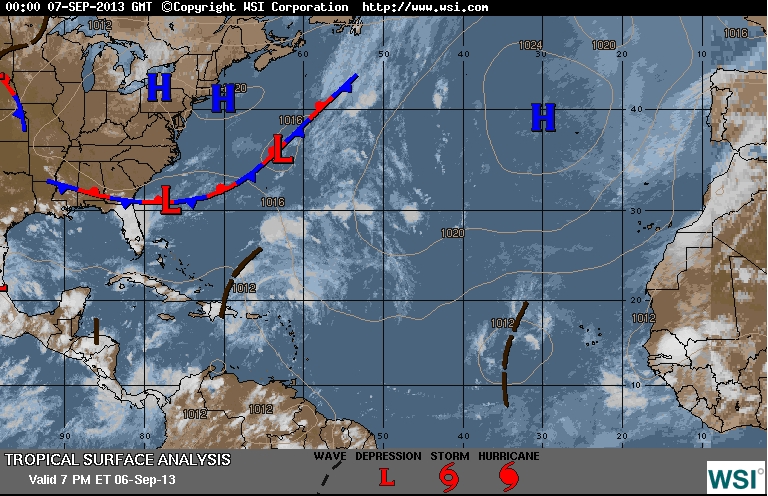


Fig 9a - Recent changes in the Saharan Air Layer

A weak tropical wave, just to the E of us, along 80W will move to inland Central America today.
A tropical wave over western Africa is expected to move over the far eastern Atlantic Ocean on Sunday...and conditions appear favorable for development after that time. This system has a low chance...20 percent...of becoming a tropical cyclone during the next 48 hours...but a high chance...80 percent...of becoming a tropical cyclone during the next 5 days. This disturbance is expected to move westward at around 10 mph near the Cape Verde Islands in the next couple of days and then west-northwestward over the open eastern Atlantic.
The SAL, has increased slightly in density. This low density and area covered, increases the probability for the first Atlantic hurricane of 2013 to form. See Figs. 9 and 9a.

low tide 3:13 am LT Moon Rise – 7:20 am LT
high tide 9:39 am LT Moon Set – 7:35 pm LT
low tide 3:44 am LT Sunrise – 5:35 am LT
high tide 9:08 pm LT Sunset – 5:56 pm LT

For text or mobile version go to: http://www.cocoviewresort.com/weather.php
No comments:
Post a Comment