The
CoCoView Resort Weather Forecast
This weather
forecast is intended for CoCoView Resort guests and applies only to
the south side of Roatan
CoCoView is at 16.4°N
Latitude x 86.4°W Longitude
in the
NW Caribbean Sea
in the
NW Caribbean Sea
CoCoView Resort, www.cocoviewresort.com
, 800-510-8164
Skies will be sunny. Winds will be easterly in direction at 10 mph to 25 mph. Sea will be moderate to calm at 1 ft. to 4 ft. The air temperatures will range from the high 70sºF to the mid to high 80s ºF or 26°C to 27ºC. Ocean water temperatures are 76°F to 78°F or 24ºC to 25ºC

 |
 |
The Tropical Weather Outlook
For the North Atlantic...Caribbean Sea and the Gulf of Mexico:
1. There are no tropical cyclones in the Atlantic at this time. The Atlantic hurricane season runs from June 1st through November 30th.
Gulf of Mexico - A squall line in the NE and N central Gulf will gradually dissipate today. A very strong cold front is forecast to sweep across the entire gulf over the weekend accompanied by a large area of strong to gale force winds across most of the waters N of 22N both E and W of the front. Conditions will greatly improve by Tue as high pressure builds in the wake of the front.
3. Caribbean Sea - Weak high pressure over the central Bahamas will shift E-NE through the weekend and into the central Atlantic by Mon... weakening trade winds across the basin today. Winds will increase across the NW Caribbean over the weekend ahead of a strong cold front forecast to move across the Gulf of Mexico. This cold front will move across the Yucatan Channel and the NW Caribbean Sun night and reach from Windward Passage to SE Nicaragua Tue morning.
3a. 1017 mb high pressure centered over the central Bahamas is maintaining generally light to gentle anticyclonic flow across the north central and northeast Caribbean and Tropical North Atlantic regions. Seas are 3 to 5 ft in these areas. Fresh trade winds are noted off the central coast of Colombia, and over the Gulf of Honduras between the high pressure to the east and troughing over southern Mexico.
3b. Trade wind flow will diminish over the south central Caribbean through early next week as the high pressure weakens and shifts east ahead of an approaching cold front. The front is forecast to reach the Yucatan Channel and the northwest Caribbean Sunday night, accompanied by strong winds and building seas. The front will reach from the Windward Passage to the eastern coast of Nicaragua Monday night, with strong southwest winds expected near the Windward Passage just ahead of the front. Over the tropical north Atlantic waters, expect continued mainly gentle to moderate trade winds and seas of 4-6 ft.

Fig 4
- Recent changes in the Saharan Air Layer
The Tides: Moon and
Sun
high tide 5:06 am LT Sunrise – 6:18 am LT>111° East
low tide 10:47 am LT Sunset – 5:39 pm LT < 250° NW
high tide 3:48 pm LT Moon Rise – 00:11 pm LT<99° East
low tide 11:00 pm LT Moon Set – 12:10 am LT>259º West
low tide 10:47 am LT Sunset – 5:39 pm LT < 250° NW
high tide 3:48 pm LT Moon Rise – 00:11 pm LT<99° East
low tide 11:00 pm LT Moon Set – 12:10 am LT>259º West
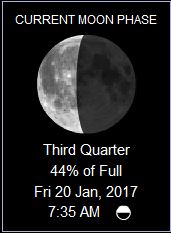
Fig 5 - Moon
Day Light Hours: 11 hours, 20 minutes, (+32s)
No comments:
Post a Comment