The
CoCoView Resort Weather Forecast
This weather
forecast is intended for CoCoView Resort guests and applies only to
the south side of Roatan
CoCoView is at 16.4°N
Latitude x 86.4°W Longitude
in the
NW Caribbean Sea
in the
NW Caribbean Sea
CoCoView Resort, www.cocoviewresort.com
, 800-510-8164
How to use this page:
The title of each of the
figures below is linked to the page where the information originates.
Since I write and post early
in the day and generally do not update the page until the next
morning; by clicking on the link, it allows you, the viewer, to get
the latest information.
This is not only convenient
but allows you to track weather events such as cold fronts and
hurricanes from a single web page.
In addition, in the right
column is a very useful widget. It is a trip planner...yesteryear's
weather at a glance.This widget lets you check historic weather for
your trip dates.
Today, skies will be partly sunny. This morning, winds will be easterly in direction at 10 mph to 15 mph or higher; increasing to 15 mph to 30 mph this afternoon and evening. Divers should exercise caution exiting and entering the boats, especially on the afternoon dives. Seas will be rough at 2 ft to 4 ft or higher.. Expect these higher winds and seas for the next week. Expect cloudiness and intermittent rain through this Sunday.
The air temperatures will range from the low to high 80s (ºF) or 26°C to 27ºC. Ocean water temperatures are 80°F to 82°F or 26ºC to 28ºC. Visibility is 20 to 80 ft.


Fig
2a – Today's Jetstream


 |
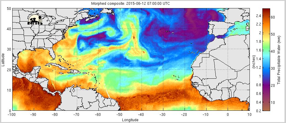
Fig 20 - Recent changes in the
Saharan Air Layer
|
 |
The Tropical Weather Outlook
For the North Atlantic...Caribbean Sea and the Gulf of Mexico:
1.SYNOPSIS...High pressure N of the area along with several passing tropical waves will maintain fresh to strong trades over mainly the central and NW Caribbean through early next week. A tropical wave over the S central Caribbean will move W through the SW Caribbean through late Sun and into Central America Mon. A second tropical wave will move across the Windward Islands late today...across the E Caribbean through Sat night...across the central Caribbean through Mon and into the SW Caribbean Tue. A third tropical wave will pass 55W Sat night...into the E Caribbean late Sun...and across the central Caribbean through Tue.
1.SYNOPSIS...High pressure N of the area along with several passing tropical waves will maintain fresh to strong trades over mainly the central and NW Caribbean through early next week. A tropical wave over the S central Caribbean will move W through the SW Caribbean through late Sun and into Central America Mon. A second tropical wave will move across the Windward Islands late today...across the E Caribbean through Sat night...across the central Caribbean through Mon and into the SW Caribbean Tue. A third tropical wave will pass 55W Sat night...into the E Caribbean late Sun...and across the central Caribbean through Tue.
2. 1. Disorganized showers and thunderstorms extending from the northwestern Caribbean Sea to Belize and the Yucatan peninsula of Mexico are primarily associated with an upper-level trough. This activity is expected to move northwestward into the southwestern Gulf of Mexico by late Sunday where development, if any, is unlikely due to strong upper-level winds.
* Formation chance through 48 hours...low...near 0 percent
* Formation chance through 5 days...low...10 percent
* Formation chance through 48 hours...low...near 0 percent
* Formation chance through 5 days...low...10 percent
3.Tropical cyclone formation is not expected in the next 24 to 48 hours.
4. The Saharan Air Layer (SAL) has decreased slightly in area and density.
4. The Saharan Air Layer (SAL) has decreased slightly in area and density.


Fig 22a - Active Atlantic Ocean Tropical
Waves

Fig 23 - 48 Hour Tropical Storm Probability
high tide 5:09 am LT Sunrise – 5:15 am LT >66° E
low tide 11:49 am LT Sunset – 6:19 pm LT <294° NW
high tide 6:29 am LT Moon Rise – 1:57 am LT >81° E
low tide 12:26 am LT Moon Set – 2:43 pm LT <281° W
low tide 11:49 am LT Sunset – 6:19 pm LT <294° NW
high tide 6:29 am LT Moon Rise – 1:57 am LT >81° E
low tide 12:26 am LT Moon Set – 2:43 pm LT <281° W

No comments:
Post a Comment