This weather
forecast is intended for CoCoView Resort guests and applies only to
the south side of Roatan
CoCoView is at 16.4°N
Latitude x 86.4°W Longitude
in the
NW Caribbean Sea
in the
NW Caribbean Sea
CoCoView Resort, www.cocoviewresort.com
, 800-510-8164
How to use this page:
The title of each of the
figures below is linked to the page where the information originates.
Since I write and post early
in the day and generally do not update the page until the next
morning; by clicking on the link, it allows you, the viewer, to get
the latest information.
This is not only convenient
but allows you to track weather events such as cold fronts and
hurricanes from a single web page.
In addition, in the right
column is a very useful widget. It is a trip planner...yesteryear's
weather at a glance.This widget lets you check historic weather for
your trip dates.
Skies will be cloudy. Winds will be easterly in direction at 10 mph to 15 mph this morning; increasing to 15 mph to 25 mph this afternoon and evening. Seas will be moderate at 2 ft to 4 ft.. There is a chance of intermittent rain, today. Expect these winds and seas through Wednesday. Expect cloudiness and intermittent rain through Thursday
The air temperatures will range from the low to high 80s (ºF) or 26°C to 27ºC. Ocean water temperatures are 80°F to 82°F or 26ºC to 28ºC. Visibility is 20 to 80 ft.


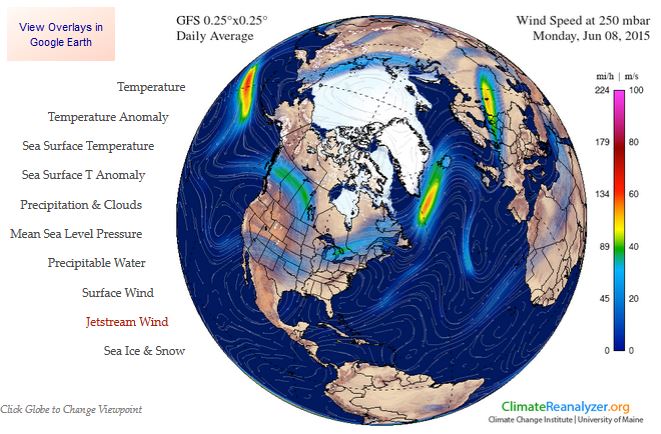
Fig
2a – Today's Jetstream


 |
Fig 20 - Recent changes in the
Saharan Air Layer
|
 |
The Tropical Weather Outlook
For the North Atlantic...Caribbean Sea and the Gulf of Mexico:
1. A tropical wave in the SW Caribbean will move inland into Central America later today.
2. A second tropical wave between Jamaica and Colombia will move across the W Caribbean including the Gulf of Honduras through Wed.
3. Atlantic high pressure will build west in the wake of the second tropical wave...gradually increasing trade winds from the S central Caribbean to the NW Caribbean through Wed.
4. Another tropical wave will move across the tropical N Atlantic waters Tue...through the Windward Islands Wed...and across the E Caribbean Thu and Fri.
6.Tropical cyclone formation is not expected in the next 24 to 48 hours.
7. The Saharan Air Layer (SAL) remains moderately large in area and high in density.


Fig 22a - Active Atlantic Ocean Tropical
Waves: 150607 to 150608

Fig 23 - 48 Hour Tropical Storm Probability
high tide 1:41 am LT Sunrise – 5:15 am LT >66° E
low tide 8:07 am LT Sunset – 6:18 pm LT <294° NW
high tide 2:23 am LT Moon Rise – 11:43 pm LT >95° E
low tide 8:23 pm LT Moon Set – 10:54 am LT <263° W
Day
Light Hours: 13 hours, 2 minute (+15 s) low tide 8:07 am LT Sunset – 6:18 pm LT <294° NW
high tide 2:23 am LT Moon Rise – 11:43 pm LT >95° E
low tide 8:23 pm LT Moon Set – 10:54 am LT <263° W

No comments:
Post a Comment