The
CoCoView Resort Weather Forecast
This weather
forecast is intended for CoCoView Resort guests and applies only to
the south side of Roatan
CoCoView is at 16.4°N
Latitude x 86.4°W Longitude
in the
NW Caribbean Sea
in the
NW Caribbean Sea
CoCoView Resort, www.cocoviewresort.com
, 800-510-8164
How to use this page:
The title of each of the
figures below is linked to the page where the information originates.
Since I write and post early
in the day and generally do not update the page until the next
morning; by clicking on the link, it allows you, the viewer, to get
the latest information.
This is not only convenient
but allows you to track weather events such as cold fronts and
hurricanes from a single web page.
In addition, in the right
column is a very useful widget. It is a trip planner...yesteryear's
weather at a glance.This widget lets you check historic weather for
your trip dates.
Skies will be mostly cloudy. Winds will be eastrly in direction at 10 mph to less today. Seas will be calm at 1 ft to 3 ft.. There is a 50% chance or higher of intermittent rain, today. Expect light winds and seas through Wednesday. Expect cloudiness and intermittent rain through next Saturday.
The air temperatures will range from the low to high 80s (ºF) or 26°C to 27ºC. Ocean water temperatures are 80°F to 82°F or 26ºC to 28ºC. Visibility is 20 to 80 ft.


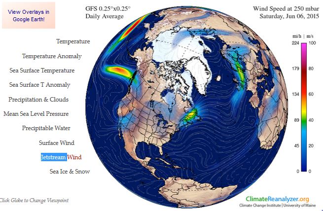
Fig
2a – Today's Jetstream


 |
Fig 20 - Recent changes in the
Saharan Air Layer
|
 |
The Tropical Weather Outlook
For the North Atlantic...Caribbean Sea and the Gulf of Mexico:
1. An Atlantic ocean tropical wave is along 20W from 10N southward...moving westward 10 to 15 kt. This position is based on long-term satellite imagery. Convective precipitation... isolated to widely scattered moderate from 3N to 10N between 14W and 23W.
2. An Atlantic ocean tropical wave is along 38W from 10N southward...moving westward 10 to 15 kt. Convective precipitation...scattered strong from 4N to 6N between 33W and 42W. 3. An Atlantic ocean tropical wave is along 51W from 10N southward...moving westward 15 kt. Convective precipitation...scattered to numerous strong from 5N to 8N between 49W and 57W.
4. A Caribbean sea tropical wave is along 67W/68W from eastern sections of the Dominican Republic southward...moving westward 15 kt. Convective precipitation...no significant deep convective precipitation is present.
5. A trough over the NW Caribbean will move into the Yucatan Peninsula Sun. A weak tropical wave will move through the central Caribbean into Mon...and across the western Caribbean through mid week. Atlantic high pressure will build n of the area through mid week behind the tropical wave...increasing SE winds from the S central Caribbean to the NW Caribbean by mid week. Another tropical wave will approach the Windward Islands by mid week.
6.Tropical cyclone formation is not expected in the next 24 to 48 hours.
7. The Saharan Air Layer (SAL) remains moderately large in area and high in density.


Fig 22a - Active Atlantic Ocean Tropical
Waves

Fig 23 - 48 Hour Tropical Storm Probability
low tide 5:56 am LT Sunrise – 5:15 am LT >66° E
high tide 11:27 am LT Sunset – 6:17 pm LT <294° NW
low tide 5:51 pm LT Moon Rise – 10:04 pm LT >103° E
high tide 12:40 am LT Moon Set – 8:58 am LT <255° W
high tide 11:27 am LT Sunset – 6:17 pm LT <294° NW
low tide 5:51 pm LT Moon Rise – 10:04 pm LT >103° E
high tide 12:40 am LT Moon Set – 8:58 am LT <255° W

No comments:
Post a Comment