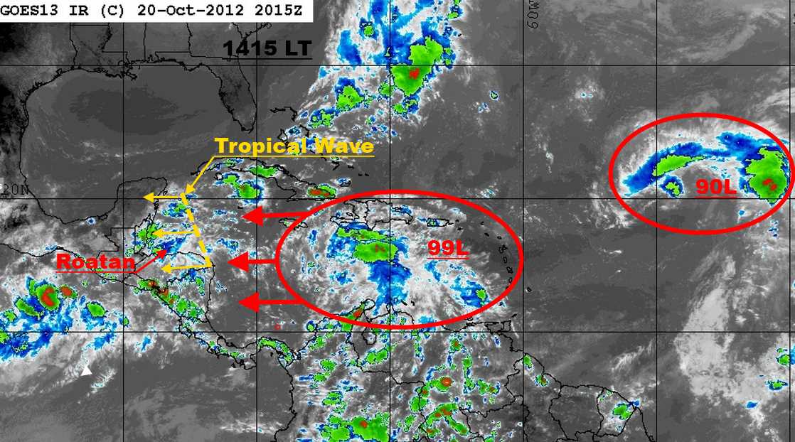
Satellite images indicate that showers and thunderstorms have become better organized in association with a tropical wave (Invest 99L) located over the central Caribbean sea. Surface pressures are falling in the area...and environmental conditions are expected to become conducive for a tropical depression to form during the next couple of days. This system has a high chance...60 percent...of becoming a tropical cyclone during the next 48 hours as the wave moves slowly westward.
The consensus of the computer models, forecast that 99L, will turn north, before it reaches the W. Caribbean Sea. However, until it does, all interests in the Bay Islands and on the North Coast of Honduras should monitor this system; as it strengthens and travels west towards us.


No comments:
Post a Comment