The
CoCoView Resort Weather Forecast
This weather
forecast is intended for CoCoView Resort guests and applies only to
the south side of Roatan
CoCoView is at 16.4°N
Latitude x 86.4°W Longitude
in the
NW Caribbean Sea
in the
NW Caribbean Sea
CoCoView Resort, www.cocoviewresort.com
, 800-510-8164
How to use this page:
The title of each of the
figures below is linked to the page where the information originates.
Since I write and post early
in the day and generally do not update the page until the next
morning; by clicking on the link, it allows you, the viewer, to get
the latest information.
This is not only convenient
but allows you to track weather events such as cold fronts and
hurricanes from a single web page.
In addition, in the right
column is a very useful widget. It is a trip planner...yesteryear's
weather at a glance.This widget lets you check historic weather for
your trip dates.
2014 Hurricane Outlook
and Forecasts
The hurricane season in this
hemisphere starts on June 01 and ends on November 30.
During that time frame, for
your convenience, you will find a section below titled, "Tropical
Weather Outlook".
It will contain the daily
tropical storm outlook, forecast and storm track(s).
NOAA predicts
near-normal or below-normal 2014 Atlantic hurricane season.
El Niño is expected to
develop and suppress the number and intensity of tropical cyclones.
This year, the Saharan Air
Layer (SAL) has been decreasing in size and density since May 21,
2014. This is important because it has been postulated, that the SAL,
a cool, dry, layer of air which contains particles, may inhibit the
formation of tropical storms and hurricanes. In addition, as it
decreases in size and density, the probability of tropical storm
formation may increase.
The outlook calls for a 50
percent chance of a below-normal season, a 40 percent chance of a
near-normal season, and only a 10 percent chance of an above-normal
season. For the six-month hurricane season, which begins June
1, NOAA predicts a 70 percent likelihood of 8 to 13 named storms
(winds of 39 mph or higher), of which 3 to 6 could become hurricanes
(winds of 74 mph or higher), including 1 to 2 major hurricanes
(Category 3, 4 or 5; winds of 111 mph or higher).
These numbers are near or
below the seasonal averages of 12 named storms, six hurricanes and
three major hurricanes, based on the average from 1981 to 2010. The
Atlantic hurricane region includes the North Atlantic Ocean,
Caribbean Sea and Gulf of Mexico.
Today, skies will be mostly sunny. Winds will be moderate and easterly in direction at 5 mph to 15 mph this morning;increasing to 15 mph to 20 mph this afternoon and evening. Seas will be calm to moderate at 1 to 4 feet. The air temperatures will range from the mid to high 70s (ºF) to the mid to high 80s (ºF) or 24ºC to 26ºC. Ocean water temperatures are 82°F to 84°F or 24ºC to 25ºC. Visibility is 20 to 80 ft.
There is a very slight chance of scattered rain showers and isolated thunderstorms, especially during the early morning, late night hours as a tropical wave moves across the area. Late morning satellite images of this system show it has expanded markedly in size. See Figs. 9, 10, 13 and 14.
Currently this system does not pose a threat to the Bay Islands and north coast of Honduras. But all interests here should monitor this system as it moves slowly west towards us.


 |
|
|


 |
|
Fig 19 - Recent changes in the
Saharan Air Layer
|
 |
The Tropical Weather Outlook
For the North Atlantic...Caribbean Sea and the Gulf of Mexico: 1. Tropical cyclone formation is not expected during the next 5 days.
2. A tropical wave across the SW Caribbean along 82W will move slowly inland across Central America today. Broad low pressure will develop across the SW and W Caribbean tonight through the end of the week. A second tropical wave moving across the tropical N Atlantic waters tonight will move across the E Caribbean Tuesday...the central Caribbean Wednesday...and the W Caribbean Thursday and Friday.
3. The SAL (Saharan Air Layer) has been decreasing in size and density for the past few days. See Fig 19 above. This is important because there is a hypothesis that the SAL which is a cool, dry, layer of air which contains particles, inhibits the formation of hurricanes and as it decreases in size and density, the probability of tropical storm formation increases.
By: Dr. Jeff Masters , 3:07 PM GMT on October 07, 2014
Quiet in the Atlantic
Our top three models for predicting tropical cyclone genesis show nothing developing over the next five days in the Atlantic, though the 06Z Tuesday run of the GFS model shows an area of disturbed weather between the Bahamas and Bermuda could develop early next week. We should also keep an eye on the Southwest Caribbean off the coast of Nicaragua late this week. Low pressure over Central America will be capable of forming a center of circulation over the Caribbean, as the GFS model has been suggesting with recent runs. Anything that develops in the Caribbean should move slowly to the northwest early next week, bringing very heavy rains to much of Central America. What is more likely to happen is that the low pressure area over Central America will spawn a strong tropical disturbance by Sunday in the Pacific off the coast of Guatemala, as predicted by the UKMET and European models. In their 8 am EDT Tropical Weather Outlook, NHC gave this Pacific disturbance 5-day development odds of 20%.

Fig 23 - 48 Hour Tropical Storm Probability
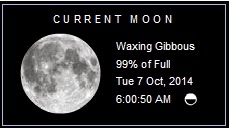
low tide 1:24 am LT Moon Rise – 5:09 pm LT
high tide 7:48 am LT Moon Set –4:42 am LT
low tide 1:48 pm LT Sunrise – 5:38 am LT
high tide 7:36 pm LT Sunset – 5:33 pm LT
high tide 7:48 am LT Moon Set –4:42 am LT
low tide 1:48 pm LT Sunrise – 5:38 am LT
high tide 7:36 pm LT Sunset – 5:33 pm LT
No comments:
Post a Comment