The
CoCoView Resort Weather Forecast
This weather
forecast is intended for CoCoView Resort guests and applies only to
the south side of Roatan
CoCoView is at 16.4°N
Latitude x 86.4°W Longitude
in the
NW Caribbean Sea
in the
NW Caribbean Sea
CoCoView Resort, www.cocoviewresort.com
, 800-510-8164
How to use this page:
The title of each of the
figures below is linked to the page where the information originates.
Since I write and post early
in the day and generally do not update the page until the next
morning; by clicking on the link, it allows you, the viewer, to get
the latest information.
This is not only convenient
but allows you to track weather events such as cold fronts and
hurricanes from a single web page.
In addition, in the right
column is a very useful widget. It is a trip planner...yesteryear's
weather at a glance.This widget lets you check historic weather for
your trip dates.
Tuesday, September 15, 2015
Skies will be partly cloudy. Winds will be moderate and easterly in direction at 10 mph to 15 mph this morning; increasing to 15 mph to 25 mph this afternoon and evening. Seas will be choppy at 2 ft to 4 ft.
The air temperatures will range from the low to high 80s ºF or 26°C to 27ºC. Ocean water temperatures are 82°F to 84°F or 27ºC to 29ºC. Expect increasing cloudiness and scattered rain showers with the passage of a tropical wave later today.


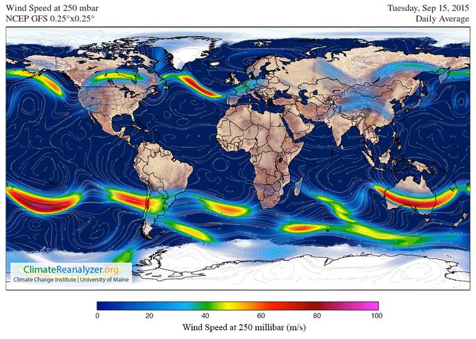
Fig
2a – Today's Jetstream


 |
Fig 20 - Recent changes in the
Saharan Air Layer
|
 |
The Tropical Weather Outlook
For the North Atlantic...Caribbean Sea and the Gulf of Mexico:
1. Synopsis...a tropical wave associated with the remnants of tropical cyclone Grace is over the W Caribbean along 82W. The wave will pass W of Cuba tonight and reach the Yucatan Peninsula by Wed. Another tropical wave is over the E Caribbean along 63W. The wave will reach the central Caribbean tonight and the W Caribbean by Thu. Weakened ridging N of the area will diminish winds in the central Caribbean Thu through Sat.
2. There are three areas of disturbed weather in the Atlantic-Caribbean-Gulf of Mexico basin. None of them currently poses a threat to the Bay Islands or north coast of Honduras.
3. The SAL has changed slightly in area and density.


Fig 22a - Active Atlantic Ocean Tropical
Waves

Fig 23 - 48 Hour Tropical Storm Probability
low tide 3:19 am LT Sunrise – 5:36 am LT>87° East
high tide 10:03 am LT Sunset – 5:50 pm LT < 273° West
low tide 3:48 pm LT Moon Rise – 7:24 am LT> 96° East
high tide 9:08 pm LT Moon Set – 7:40 pm LT < 273° West
high tide 10:03 am LT Sunset – 5:50 pm LT < 273° West
low tide 3:48 pm LT Moon Rise – 7:24 am LT> 96° East
high tide 9:08 pm LT Moon Set – 7:40 pm LT < 273° West

No comments:
Post a Comment