The
CoCoView Resort Weather Forecast
This weather
forecast is intended for CoCoView Resort guests and applies only to
the south side of Roatan
CoCoView is at 16.4°N
Latitude x 86.4°W Longitude
in the
NW Caribbean Sea
in the
NW Caribbean Sea
CoCoView Resort, www.cocoviewresort.com
, 800-510-8164
How to use this page:
The title of each of the
figures below is linked to the page where the information originates.
Since I write and post early
in the day and generally do not update the page until the next
morning; by clicking on the link, it allows you, the viewer, to get
the latest information.
This is not only convenient
but allows you to track weather events such as cold fronts and
hurricanes from a single web page.
In addition, in the right
column is a very useful widget. It is a trip planner...yesteryear's
weather at a glance.This widget lets you check historic weather for
your trip dates.
2014 Hurricane Outlook
and Forecasts
The hurricane season in this
hemisphere starts on June 01 and ends on November 30.
During that time frame, for
your convenience, you will find a section below titled, "Tropical
Weather Outlook".
It will contain the daily
tropical storm outlook, forecast and storm track(s).
NOAA predicts
near-normal or below-normal 2014 Atlantic hurricane season.
El Niño is expected to
develop and suppress the number and intensity of tropical cyclones.
This year, the Saharan Air
Layer (SAL) has been decreasing in size and density since May 21,
2014. This is important because it has been postulated, that the SAL,
a cool, dry, layer of air which contains particles, may inhibit the
formation of tropical storms and hurricanes. In addition, as it
decreases in size and density, the probability of tropical storm
formation may increase.
The outlook calls for a 50
percent chance of a below-normal season, a 40 percent chance of a
near-normal season, and only a 10 percent chance of an above-normal
season. For the six-month hurricane season, which begins June
1, NOAA predicts a 70 percent likelihood of 8 to 13 named storms
(winds of 39 mph or higher), of which 3 to 6 could become hurricanes
(winds of 74 mph or higher), including 1 to 2 major hurricanes
(Category 3, 4 or 5; winds of 111 mph or higher).
These numbers are near or
below the seasonal averages of 12 named storms, six hurricanes and
three major hurricanes, based on the average from 1981 to 2010. The
Atlantic hurricane region includes the North Atlantic Ocean,
Caribbean Sea and Gulf of Mexico.
Sunday, November
02, 2014
Today, skies will be
mostly cloudy. Winds will be fresh and NE to NNE in direction at 15
mph to 25 mph . Seas
will be choppy to rough at 2 to 4 feet. The air temperatures will
range from the mid to high 70s (ºF) to the mid to high 80s (ºF) or
24ºC to 26ºC. Ocean water temperatures are 82°F to 84°F or 24ºC
to 25ºC. Visibility is 20 to 80 ft.
There is a chance of
scattered, heavy rain showers and isolated thunderstorms.
With wind chill, it will
feel like the mid 60s F, especially when exiting the water.
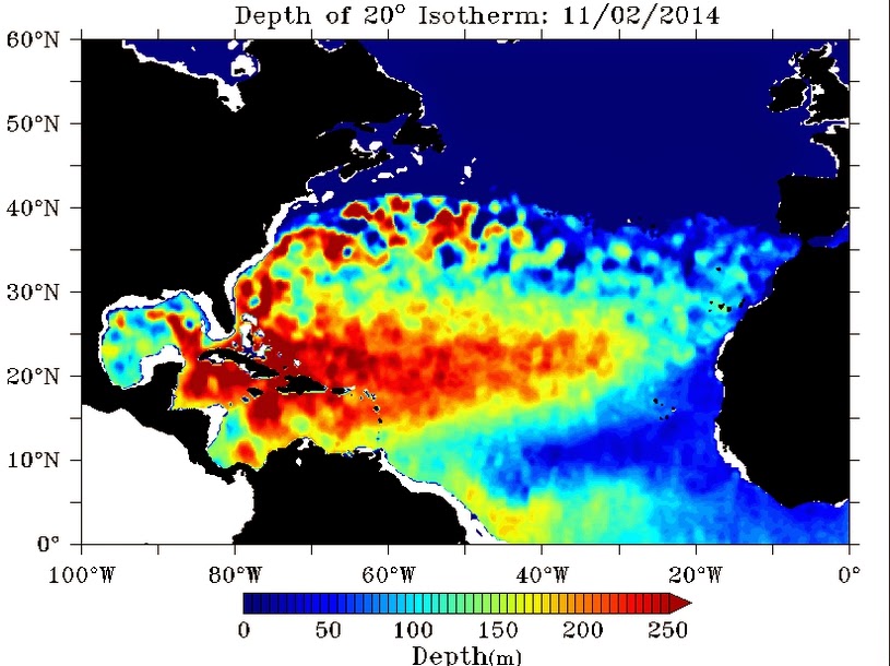
There is a thermocline at 10ft. to 15 ft.


 |
|
|


 |
|
Fig 19 - Recent changes in the
Saharan Air Layer
|
 |
The Tropical Weather Outlook
For the North Atlantic...Caribbean Sea and the Gulf of
Mexico:
1.0 Tropical cyclone formation is not expected during
the next 5 days.
2.0 A strong cold front moving into the NW Caribbean
will merge with a stationary front and stall from the Windward
passage to E Honduras through late today...then become diffuse
through mid week. High pressure building N of the area behind the
front will allow strong NW flow and building seas over much of the W
Caribbean through Tue. Winds and seas will diminish across the basin
Wed and Thu as the high pressure weakens. NW swell to 8 ft will move
into the area E of the Leeward Islands Mon through Wed.


Fig 21a - Graphical 5 Day Tropical Weather Outlook


Fig 23 - 48 Hour Tropical Storm Probability
high tide 5:16 am LT Moon Rise –2:12 pm LT
low tide 11:24 am LT Moon Set –1:32 am LT
high tide 5:17 pm LT Sunrise – 5:44 am LT
low tide 11:43 pm LT Sunset – 5:17 pm LT
low tide 11:24 am LT Moon Set –1:32 am LT
high tide 5:17 pm LT Sunrise – 5:44 am LT
low tide 11:43 pm LT Sunset – 5:17 pm LT

No comments:
Post a Comment