The
CoCoView Resort Weather Forecast
This weather forecast is intended for CoCoView Resort guests and applies only to the south side of Roatan
CoCoView is at 16.4°N Latitude x 86.4°W Longitude
in the
NW Caribbean Sea
CoCoView Resort, www.cocoviewresort.com , 800-510-8164
CoCoView is at 16.4°N Latitude x 86.4°W Longitude
in the
NW Caribbean Sea
CoCoView Resort, www.cocoviewresort.com , 800-510-8164
How to use this page:
The title of each of the figures below is linked to the page where the information originates.
Since I write and post early in the day and generally do not update the page until the next morning; by clicking on the link, it allows you, the viewer, to get the latest information.
This is not only convenient but allows you to track weather events such as cold fronts and hurricanes from a single web page.
In addition, in the right column is a very useful widget. It is a trip planner...yesteryear's weather at a glance.This widget lets you check historic weather for your trip dates.
2014 Hurricane Outlook and Forecasts
The hurricane season in this hemisphere starts on June 01 and ends on November 30.
During that time frame, for your convenience, you will find a section below titled, "Tropical Weather Outlook".
Wednesday, June 11, 2014
Again today, skies will be partly sunny
and occasionally hazy. Winds will be easterly in direction at 10 mph
to 15 mph this morning; increasing to 20 mph to 25 mph or higher this
afternoon and evening. Seas
will be choppy at 2 to 4 feet.
Divers should exercise caution
exiting and entering the boats, especially on the afternoon dives.
Winds and seas are now forecast to
remain at this strength through the beginning of next week. For more
details, see the weekly weather forecast posted else where in the
resort or go to: http://www.windfinder.com/forecast/isla_de_roatan
There is a very slight chance of
scattered rain showers and isolated thunderstorms, especially during
the early morning, late night hours.
The air temperatures will range from
the low to mid 70s (ºF) to the low to mid 80s (ºF) or 24ºC to
26ºC.
Ocean water temperatures are 80°F to
82°F or 24ºC to 25ºC. Visibility is 20 to 80 ft.


Fig 18 - Recent changes in the Saharan Air Layer

The Tropical Weather Outlook
There are no tropical cyclones in the
Atlantic at this time.
A tropical wave will pass through the
SE Caribbean waters S of 11N today and Thursday...through the S
central Caribbean waters on Thursday night and Friday...and through
the SW Caribbean on Saturday. A second tropical will pass through the
tropical Atlantic waters S of 13N on Thursday night and
Friday...through the SE Caribbean on Friday night through Saturday
night...and through the central Caribbean waters on Sunday.
Dry air from a Saharan Air Layer outbreak continues to move across the central and eastern Caribbean thus supporting fair but hazy weather.


low tide 1:14 am LT
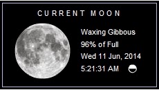
Moon Rise – 4:58 pm LT
high tide 6:10 am LT
Moon Set – 3:48 am LT
low tide 1:13 pm LT
Sunrise – 5:15 am LT
high tide 8:10 pm LT
Sunset – 6:19 pm LT
No comments:
Post a Comment