The
CoCoView Resort Weather Forecast
This weather
forecast is intended for CoCoView Resort guests and applies only to
the south side of Roatan
CoCoView is at 16.4°N
Latitude x 86.4°W Longitude
in the
NW Caribbean Sea
in the
NW Caribbean Sea
CoCoView Resort, www.cocoviewresort.com
, 800-510-8164
Thursday, June 30, 2016
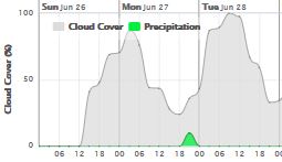
Skies will be partly sunny. Winds will be easterly in direction at 10 mph to 30 mph or higher. Seas will be moderate to rough at 2 ft to 4 ft or higher.
The air temperatures will range from the high 70sºF to the mid to high 80s ºF or 26°C to 27ºC. Ocean water temperatures are 80°F to 82°F or 26ºC to 27ºC.

 |
The Tropical Weather Outlook
For the North Atlantic...Caribbean Sea and the Gulf of Mexico:
1. Gulf of Mexico - High pressure will persist over the eastern Gulf through early next week while weak troughing lingers across the NW and central Gulf. A trough will move westward off the Yucatan Peninsula into the SW Gulf each evening before dissipating each morning.
2. Caribbean Sea - A high pressure ridge across the SW N Atlantic combined with low pressure over northern Colombia will support fresh to strong trades across the majority of the central Caribbean through next week. Winds will reach minimal gale force in the Gulf of Venezuela tonight. Moderate to fresh trades will prevail elsewhere.
3. Tropical cyclone formation is not expected during the next 5 days.
4. Tropical Waves...
4a. Tropical wave extends from 06N28W to 13N32W moving W at 15 kt. The wave coincides with subtle 700 mb troughing between 25W-34W and remains embedded within Saharan dust north of the Monsoon Trough region. As a result...scattered moderate convection is confined within 150 nm either side of a line from 08N23W to 04N32W.
4b. Tropical wave extends from 06N54W to 16N58W moving W at 20 kt. The wave coincides with 700 mb troughing between 52W-60W. No significant deep convection is associated with the wave at this time.
4c. Tropical wave extends from 05N71W to 15N71W moving W at 15 kt. The wave continues moving on the southern periphery of a SW North Atlc mid-level ridge anchored near 30N60W. Scattered moderate convection is across Venezuela and portions of northern Colombia from 02N-10N between 64W-75W.

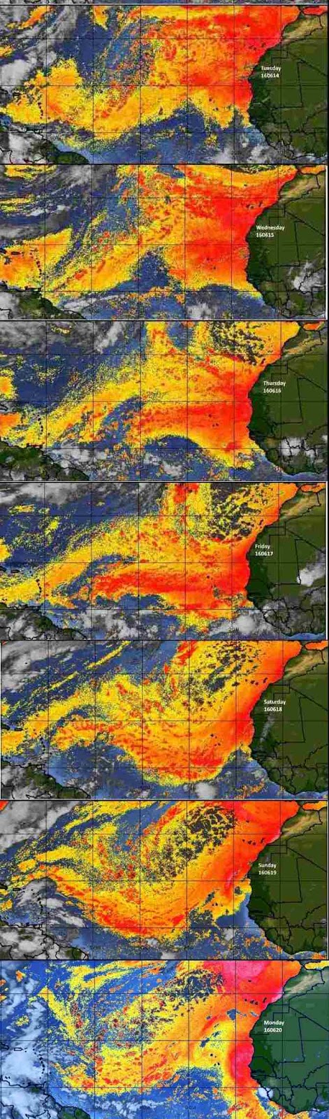
Fig 3
- Recent changes in the Saharan Air Layer
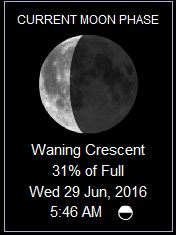
The Tides: Moon and
Sun
high tide 4:57 am LT Sunrise – 5:19 am LT>66° East
low tide 11:40 am LT Sunset – 6:22 pm LT < 294° NW
high tide 6:23 pm LT Moon Rise – 01:47 am LT<78° East
low tide 12:16 am LT Moon Set – 2:44 pm LT>284º West
low tide 11:40 am LT Sunset – 6:22 pm LT < 294° NW
high tide 6:23 pm LT Moon Rise – 01:47 am LT<78° East
low tide 12:16 am LT Moon Set – 2:44 pm LT>284º West
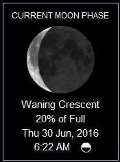
Fig 4 - Moon
Day Light Hours: 13 hours 3 minute (-11s)