The
CoCoView Resort Weather Forecast
This weather
forecast is intended for CoCoView Resort guests and applies only to
the south side of Roatan
CoCoView is at 16.4°N
Latitude x 86.4°W Longitude
in the
NW Caribbean Sea
in the
NW Caribbean Sea
CoCoView Resort, www.cocoviewresort.com
, 800-510-8164
How to use this page:
The title of each of the
figures below is linked to the page where the information originates.
Since I write and post early
in the day and generally do not update the page until the next
morning; by clicking on the link, it allows you, the viewer, to get
the latest information.
This is not only convenient
but allows you to track weather events such as cold fronts and
hurricanes from a single web page.
In addition, in the right
column is a very useful widget. It is a trip planner...yesteryear's
weather at a glance.This widget lets you check historic weather for
your trip dates.
Skies will be partly cloudy. Again, winds will be light and variable in direction at 5 mph to10 mph today or less. Seas will be calm at 1 ft to 2ft.
The air temperatures will range from the low to high 80s ºF or 26°C to 27ºC. Ocean water temperatures are 80°F to 82°F or 26ºC to 28ºC.
There is a very slight chance of scattered rain showers and isolated thunderstorms. Expect winds and seas to increase in strength beginning tomorrow.


Fig
2a – Today's Jetstream


 |
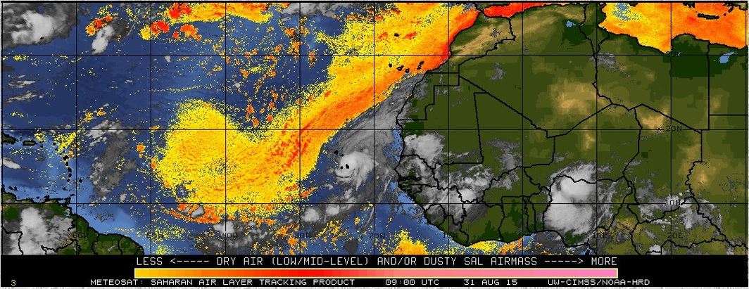
Fig 20 - Recent changes in the
Saharan Air Layer
|
 |
The Tropical Weather Outlook
For the North Atlantic...Caribbean Sea and the Gulf of Mexico:
1. Fresh to strong trade winds will persist across the central Caribbean through early Wed as high pres remains N of area...then will diminish as the high pres shifts SE and weakens. A tropical wave along 73W will move W and across the W Carib tonight through Tue night. The next tropical wave along 58W will move across the Lesser Antilles this afternoon and into the Carib this evening then across the E Carib tonight through Tue...and across the central Carib Tue night and Wed...then across the W Carib Wed night through Thu night.
2. Hurricane Fred is bringing strong winds and heavy rains to the Cape Verde Islands.
3. All interests in the Bay Islands and on the North Coast of Honduras should monitor this system closely as it tracks westward toward us. See Figs. 2 and 23b.
Currently this system does not pose a threat to the Bay Islands and north coast of Honduras.
4. The Saharan Air Layer (SAL) has increased slightly in area. See Figs. 18 and 20.


Fig 22a - Active Atlantic Ocean Tropical
Waves

Fig 23 - 48 Hour Tropical Storm Probability

Fig 23a - Hurricane Fred Distance to Roatan

Fig 23b - Hurricane Fred US Navy Track and Forecast Track
Results for Roatan, Bay Islands, Honduras (16.38N, 86.45W):
The approximate Closest Point of Approach (CPA) is located near 24.0N, 41.0W or about 2985.3 miles (4804.4 km) from your location. This is corresponding with the120 hour position of the 5-day forecast (Saturday, September 5 at 11:00AM AST).
The approximate Closest Point of Approach (CPA) is located near 24.0N, 41.0W or about 2985.3 miles (4804.4 km) from your location. This is corresponding with the120 hour position of the 5-day forecast (Saturday, September 5 at 11:00AM AST).
Just for 'fun'... If the storm would continue on this track, the extrapolated closest point (X-CPA) is estimated at 38.4N, 74.6W or about 1678.5 miles (2701.2 km)from your location, where it can be in about 1 week, 6 days, 22 hours and 36 minutes from now (Monday, September 14 at 11:00AM AST, be aware that this location is not part of the official forecast and is prone to large errors).

Fig 23c - Hurricane Fred CPA to Roatan

Fig 23d - Hurricane Fred Computer Models
low tide 3:35 am LT Sunrise – 5:34 am LT>81° East
high tide 9:54 am LT Sunset – 6:02 pm LT < 279° West
low tide 3:55 pm LT Moon Rise – 7:49 pm LT> 86° East
high tide 9:47 pm LT Moon Set – 7:20 am LT < 271° West
high tide 9:54 am LT Sunset – 6:02 pm LT < 279° West
low tide 3:55 pm LT Moon Rise – 7:49 pm LT> 86° East
high tide 9:47 pm LT Moon Set – 7:20 am LT < 271° West


