The
CoCoView Resort Weather Forecast
This weather forecast is intended for CoCoView Resort guests and applies only to the south side of Roatan
CoCoView is at 16.4°N Latitude x 86.4°W Longitude
in the
NW Caribbean Sea
CoCoView Resort, www.cocoviewresort.com , 800-510-8164
How to use this page:
The title of each of the figures below is linked to the page where the information originates.
Since I write and post early in the day and generally do not update the page until the next morning; by clicking on the link, it allows you, the viewer, to get the latest information.
This is not only convenient but allows you to track weather events such as cold fronts and hurricanes from a single web page.
In addition, in the right column is a very useful widget. It is a trip planner...yesteryear's weather at a glance.This widget lets you check historic weather for your trip dates.
Wednesday July 31,
2013
Today,
skies
will be partly cloudy. Seas
will be calm at 1 to 3 feet.
Winds will be mainly easterly in direction, this morning, at 10 mph
or less; increasing this afternoon and evening to 10 mph to 12 mph.
In the afternoon, winds will be ENE to NE in direction.
The air temperatures will range from
the mid 80s (ºF) to the low 90s (ºF) or 25ºC to 32ºC.
Ocean
water temperatures are 82°F
to 84ºF or 27ºC
to 28ºC. Visibility is generally 20 to 80 feet.
There
is a very slight chance of late night, early morning, intermittent
rain showers.
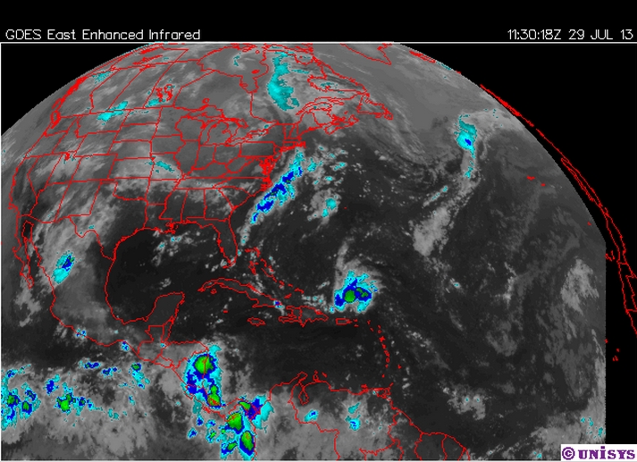
The
southern portion of a tropical wave in the central Caribbean will
move into the Western Caribbean today...then NW into the Gulf of
Mexico by late Thursday.


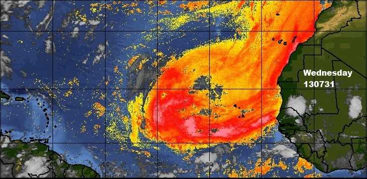

Fig 9a - Recent changes in the Saharan Air Layer

The Tropical Weather Outlook
A weak tropical wave in NW Caribbean will move into the SE Gulf of
Mexico early Thursday.
Remnants of Dorian...continue to produce a small but concentrated
area of showers and thunderstorms over the Turks and Caicos Islands
and SE Bahamas.
Overnight,the Saharan Air Layer (SAL) has increased significantly in
area and density.
Else
where, tropical cyclone formation
is not expected during the next 48 hours.

The Tides: Moon and Sun
high tide 4:31 am LT Moon
Rise – 1:18 pm LT
low tide 11:18 am LT Moon
Set – 1:34 am LT
high tide 5:59 pm LT Sunrise – 5:28 am LT
low tide 12:07 am LT Sunset
– 6:19 pm LT

For text or mobile version go to:
http://www.cocoviewresort.com/weather.php